Feb 24, 2025–Jul 6, 2025 (All Day)
Mapping San Diego
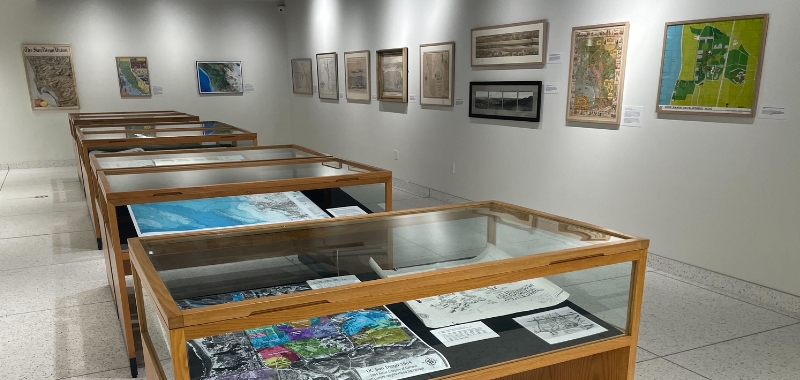
A stunning exhibition of maps of California and the San Diego region from 17th century explorations to today’s selling of the California dream.
This exhibition takes you on a journey through time and scale to explore maps of California, San Diego, and the UC San Diego campus. We begin with early representations of California as an island, and follow the coastline as it changes with the accumulation of more detailed information. As we zoom in on the campus, we see plans and visions for the campus as well as historical aerial photography of what the campus once looked like when Route 101 ran through what is now Ridgewalk.
You can find more maps about these geographic areas as well as other parts of the world in UC San Diego Library’s collections. Maps, charts, and geospatial datasets used to make interactive maps can be found in Special Collections & Archives, the Maps and Charts Collection, and in the Data & GIS Lab.
Special thanks to Barry Lawrence Ruderman Antique Maps for the personal loan and the UC San Diego GIS Department for providing campus boundary data.
Date and Time
Feb 24, 2025–Jul 6, 2025
(All Day)
Location
Exhibition Gallery at Geisel Library
Event Registration
Registration is not required for this event.
Event Fee
Free
Contact
Lynda Claassen • ucsdlibrary@ucsd.edu
Audience
Faculty, Staff, Students, The General Public, Alumni, Parents and Family
Event Host
UC San Diego Library